Places Module
Introduction
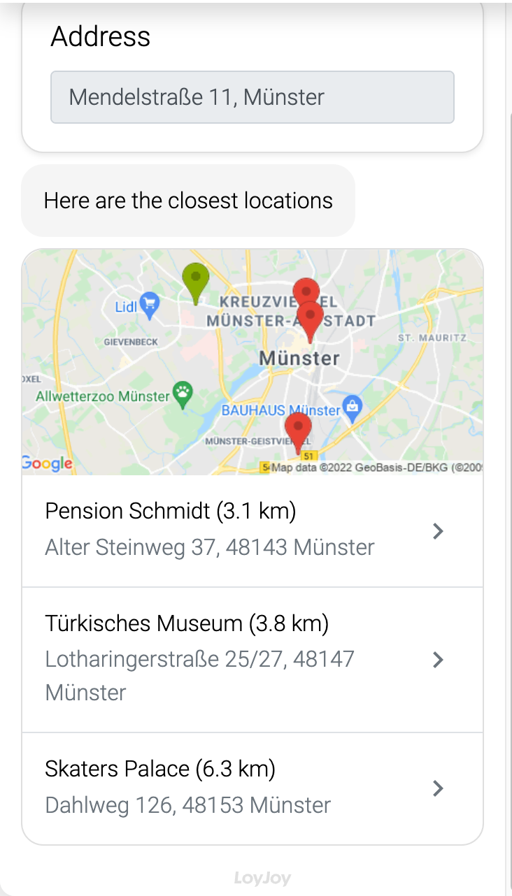
Let the user enter an address and calculate the distances to a set of destinations. The closest 4 destinations are shown as a list. Using addresses solely will always result in the point being snapped to the road nearest to those addresses instead of the location itself. As this process module integrates Google Maps, several Google Maps Platform API keys are mandatory. Furthermore, if you provide more than 25 different destinations, the latitude and longitude of each destination is required.
Typical Use Cases
Places offer a great addition to an experience, where for example, a product finder is used. You can display your products within the chat and can then show the retailers offering your products.
How to Use the Module
Google Sheets
Learn how to connect your Google sheet data via connectors.
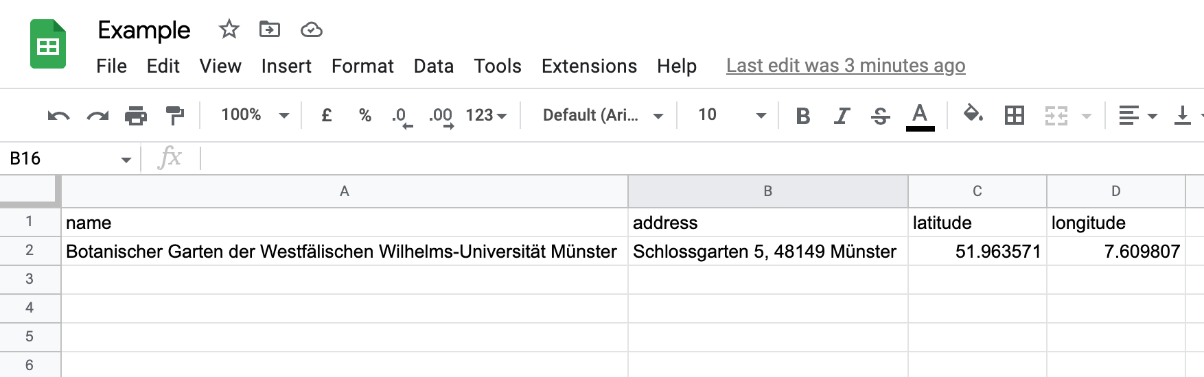
See here for an example Google Sheet. The first row is expected to hold the column names.
Please note that the name and address columns are required in all cases. The latitude
and longitude columns are only required when there are more than 25 entries. The following columns are optional: id, contact_email, contact_phone_number, contact_website.
Note that the first line of the Google Sheet contains only lower case letters!